Namik to Khaljuni Trek | May 2026 | Indian Western Himalayas Traverse Guide - Bageshwar, Uttarakhand
Namik to Khaljuni is a Trek in Kumaon Region of Bageshwar District Uttarakhand. Complete Guide, No of Days, Route with GPX file, Food Management, Elevation Gain, Trans Uttarakhand Traverse.
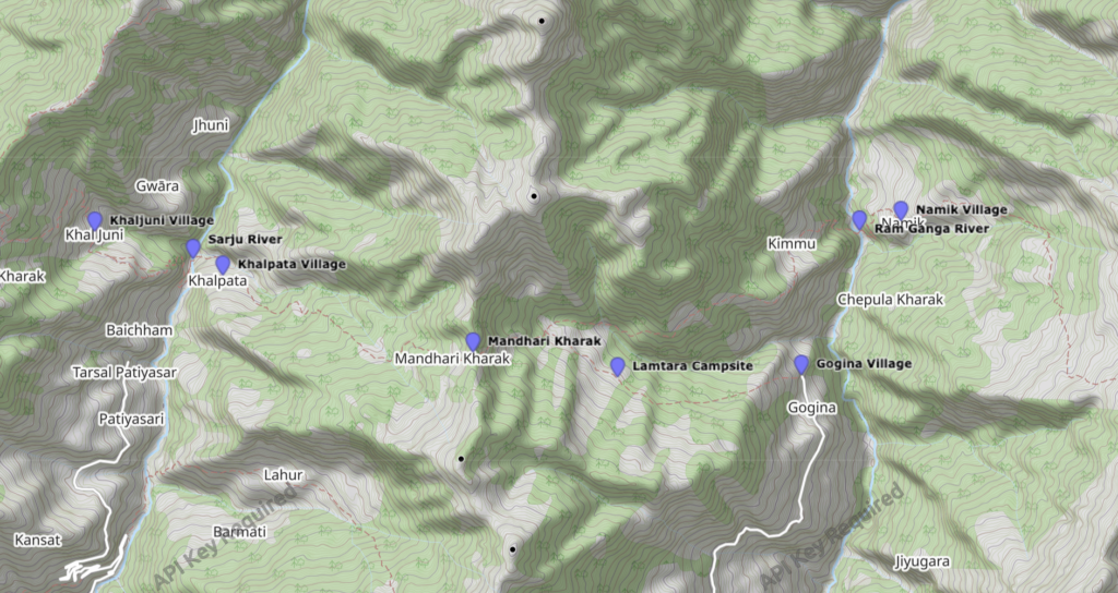
Namik is a small hamlet which has homestays and not so good network coverage of Jio or Airtel SIM. This blog is in continuation of the last section Munsyari – Namik[here] of Trans Uttarakhand Traverse [ here ].
As the time was only 3 PM, i took a decision to cover more distance. Although my knees were telling me stop, but after having a wholesome lunch, i got some energy and will to move. Distance was not more than 5 km, From Namik you hike down to a bridge over Ram Ganga River and then from there a very short hike till the Road. You walk all the way to Gogina on a not so finished road.
I stopped at a small shop, had a tea and was asking for a place to pitch my tent. I was provided with the information that i can pitch my tent in the local school or a ground, where i can also get a privilage to use community Wifi. However you will get a decent network coverage of JIO/Airtel in this village. Another option is homestay. I negotiated my price for 800 rupees with dinner and breakfast.
It was a beautiful evening in the village, i put my bag in the room and went for a cold water bath, cleared myself. What a feeling to have bath, i believe once you are on these kind of journey you start feeling happy even with smallest of actions. What is there to be happy about having a bath you have it everyday right? There is something in that environment which makes you happy about everything you have and be happy about it. Then i went for a little stroll around the village.
Next Morning, woke up had a breakfast and continued my hike. Just before you pick up the trail, you need to cross a very small hamlet with few houses. As i was crossing locals were farming there, one guy asked me about where i am going. After the discussion, I came to know one shepherd is also leaving for shepherds camp. So he insisted me to join him that way it would be easier for me to hike through the forest. The trail is pretty much well maintained till the Shepherds camp and the place is called “Lamtara Kharak“.
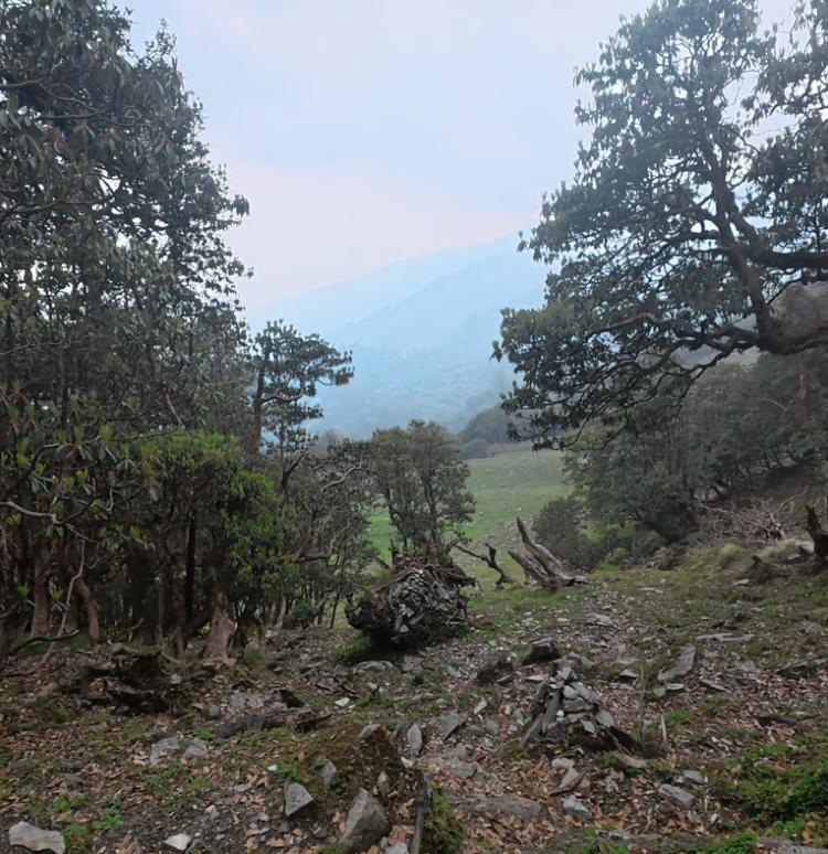
Then comes the tricky section, where you will have to do little work to walk on the right trail because there is none there. You have to follow the elevation and contour then rough idea about the trail and move.
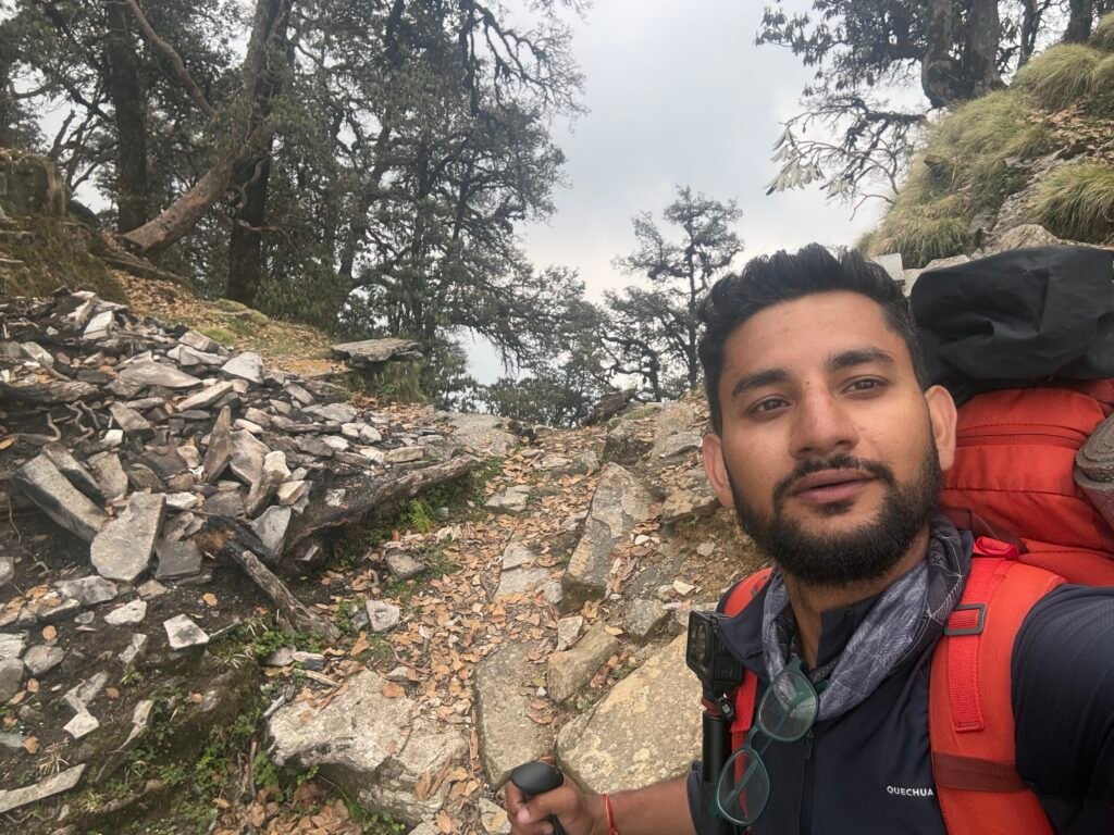
After looking at GPS more than 20 times and questioning myself almost every 5 minute whether this is the trail or not. I reached below the Pass – Mandhari Kharak stands at an altitude of 3040 meters hidden behind the trees and rocks. Once you cross the pass, you will get to see a Meadow, lush green with some Shepherds camp – Sheeps, dogs and buffalos. After some 50 meter descent, I sat near a small temple and had biscuit and water.
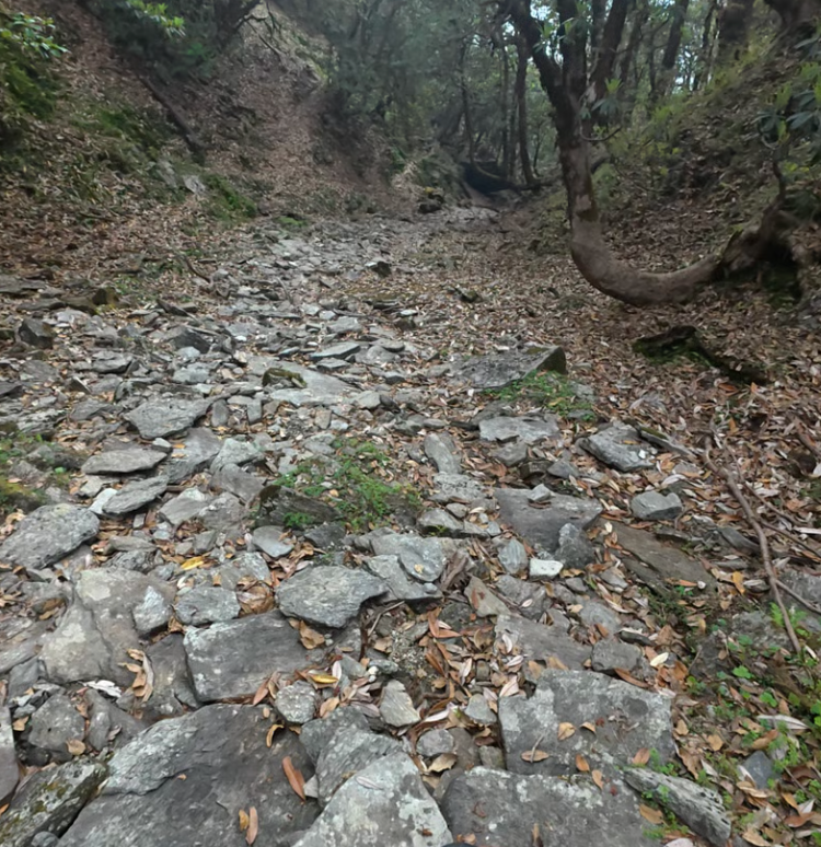
In Between Mandhari Kharak and Bhainsiya Kharak, the trail is pretty much bad and there is a section which is a gully where your GPS doesn’t even show you the right position. This gully is of around 30 to 60 meters and then you have to take left to be on the right trail. Once you reach Bhainsiya Kharak, there are lot of shepherds camp till you reach Khalpata village.
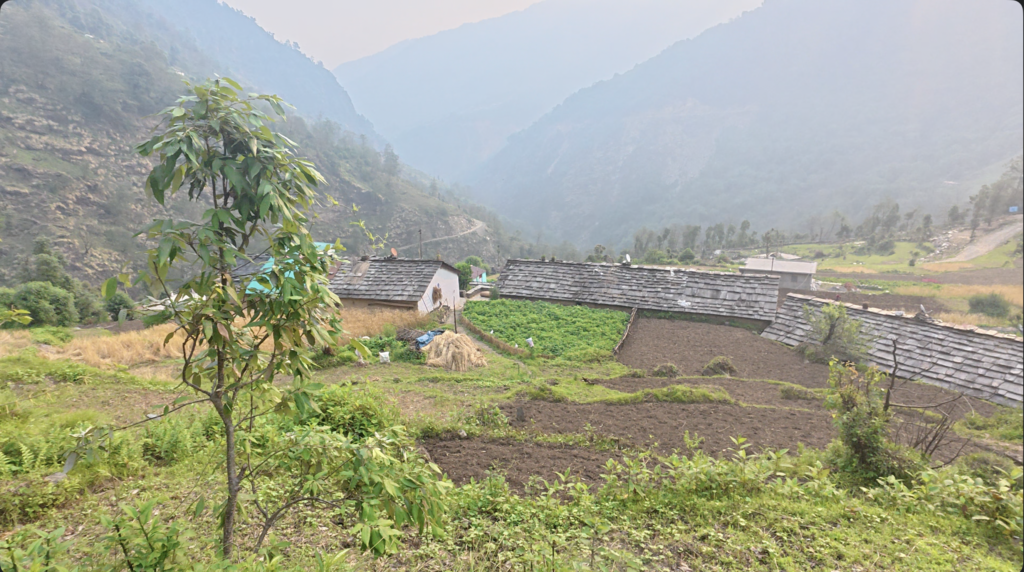
Reached Khalpata village around 2 PM. Had a cold drink and some snacks from the small shop in the village. JIO/Airtel does not work in Khalpata only BSNL. As per my observation in the Kumaon region which is less touristic at most of the villages BSNL SIM works and in Garhwal you will have Jio/Airtel and very few village with BSNL connectivity. So better to have Jio/BSNL rather than Airtel. As i had atleast 2 to 3 hours before the dark, decided to move to next village Khaljuni. It all depends on your pace and physical strength, if you feel your body allows to do some more kilometers do it, next day you will have to walk less during the uphill. My strategy is i try to reach near the pass and camp, be it a campsite or a village.
There are 2 shops in the village and homestays. When i reached there, i was looking for a place to pitch my tent. One old uncle said as i was alone i can stay in his homestay and just pay for lunch. Not a bad deal! Again you won’t get any network coverage just BSNL. where i stayed local school teacher was also staying so i used internet via hotspot. Village itself is very beautiful, very few people mostly old age peoples and every evening they sit down and have a talk and laugh. Which we generally miss now a days especially after the smart phones took over our life. We have forgot to socialise. If you are intrested in pitching your tent, you can also do that in a local school ground. You won’t find any dhaba just 2 shops, where you can buy biscuits, choclate or maggi packets.
I said my goodnight and went to sleep around 9 PM and that is the end of this section.
You can read previous Blogs [ here ]
Final Note for Independent Hikers
If you are interested in learning independent and solo hiking in the Indian Himalayas, you can opt for the Life On Trails Field Bootcamp in Manali – a 5-day field bootcamp, not just theory.
Where I share my knowledge from hiking 1100+ km from Uttarakhand to Leh Ladakh. I teach Navigation Techniques, Campsite & Shelter Selection, Food & Water Management, Topography and Contouring, Minimalist Gears, Season & Weather Selection, Wildlife & Safety, and Culture & Villages.
You can reach out to me on WhatsApp: 8800822842 or visit lifeontrails.in