Trans Uttarakhand Traverse | Wan To Pana | Lord Curzon Trail | May - June 2026
Trail Notes For Section Wan to Pana (Lord Curzon Trail) From Solo 900 KM Sub-4000 meter hike through Uttarakhand with route GPX, Trail Information, Elevation Gain and Route Map
In Indian Hiking community everybody know about famous Kuari Pass Trek, only few are aware that the pass can be hiked from behind. Pana Village to be considered as a starting point of the Trek. During my Trans Uttarakhand Traverse for me it was just another section to complete. I Started from Wan Village and to reach Pana in two days. Although much of this section is connected to civilization and developed roads to almost all the villages i passed through. While writing about this an interesting fact came infront of my eyes, that this trail is also known as Lord Curzon Trail. A point worth mentioning here, Curzon journey is what gave this trail its name, does not mean that the trail was explored by him. In today’s time on all the trails we walk, passes we hike to were being used by local villagers from hundereds of years. There are so many trails which are still to be walked on, passes to be hiked, and which are still untouched by the flood of hikers, these thoughts makes me curious to find them and map them. I do understand that mapping them will open the gates for the hikers to go there, but that does not mean that we have the authority to spoil the beauty of the place. Each and Every person is welcomed by nature, if we left that place as it was. I as a hiker followed this principle on my more than 1100+ km of Independent hiking in the himalayas. I never left my non-biodegradable waste anywhere on the trails, always to carry it back to the town or village, where you can put it in dustbin.
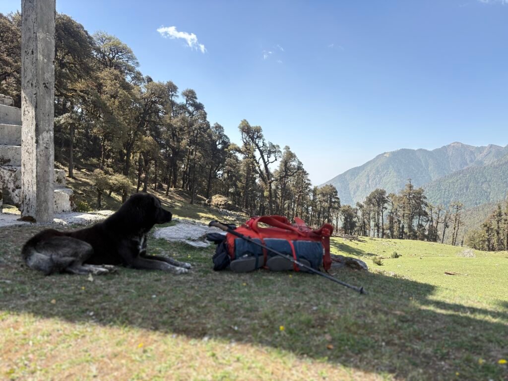
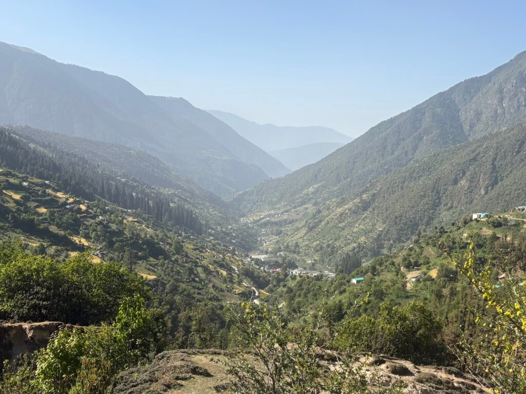
Wan To Pana as now connected mostly to civilization and connected, so it offers you very limited view of the mountain peaks. However it provides the opportunity to have beautiful campsites to pitch your tent in solitude.
GPX file of the route from Wan to Sitel can be downloaded from here: Download
GPX file of the route from Sitel to Pana can be downloaded from here: Download
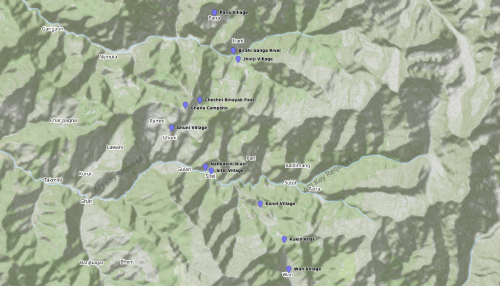
The Journey Starts from Wan village, you climb north wards towards Kukin Khal a sadle on a ridge. You hike west on the ridge, which will take you to Monal Top and east ridge connects to the trail towards Roopkund. I was also joined by a dog from the village, from him to walk with me i had to scare off so many dogs of in between villages. We spend little time at Kukin Khal, then started walking down north-west on the ridge towards Kanol Village. Now the village is well connected with road, which is still under construction. After walking some 200 meters after crossing the village, stopped to remove my shoes and wear my slippers. Trekking shoes have hard surface and it hurt your feet if you walk on road wearing them. While changing into slippers on the side of the road, I saw a bike crossing me and i waved my hand for lift. They stopped and gave me lift, in a hurry lifted my bagpack and ran towards them. Only sad part is that i had to leave the dog behind, because i couldn’t take him with me. I got a lift till sitel village, where i stopped to have a lunch. There are shops and you can buy food, biscuits and other things. I bought two flavoured milk bottles and choclates.
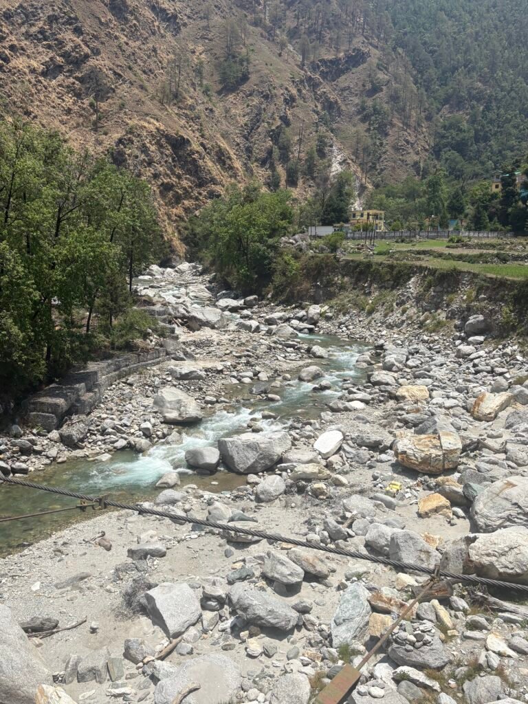
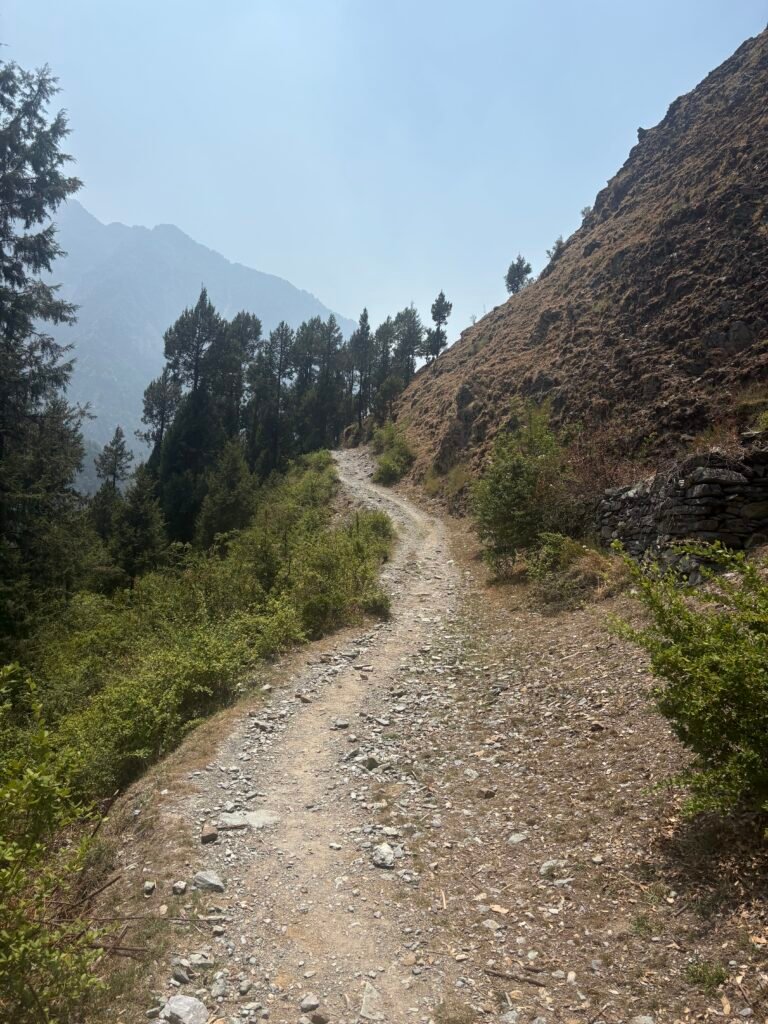
From Sitel you move north crossing Nandakini River using a bridge. Moving further you cross a village which is a part of Sitel itself and there is few hundered meters of steep climb. Then trail goes north west and passes through small hamlets. After a km or two, there is a road head, which goes towards Padar or Padarghaw Village and also stretches to Ghuni Village. After reaching Road head, i was able to get a lift in a taxi going towards Ghuni with me few school children also get lucky. We sat on the roof of the taxi. It was a ride of some 20 odd minutes and the time was around 2:30 PM.
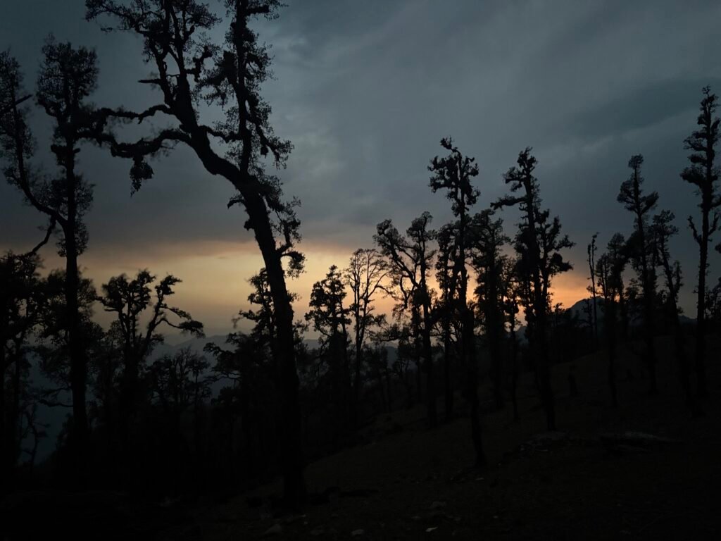

It was little early to pitch my tent. So I decided to move to Ghana Campsite, which was 3 or 4 km in distance from Ghuni Village. As now i was aware of my pace after walking more than 200 km, So i knew i would cover this distance in less than 2 hours before sunset. However first km made me question my own decision, as it was 3 PM with sun over the head and a steep loose rock patch. After enduring much of exhaustion for 30 to 40 minutes, was able to climb this patch and reach a meadow. From the meadow, you cross a beautiful forest on the ridge and you move north till trail moves from ridge to a slope into a small valley. A stream is visible on the Map near the campsite, however when i reached the campsite the stream was dry. Fortunately, i could see some brick made shepherds camp, 3 or 4 houses. However all of them were empty that time.
Around 5 PM i reached there and inspecting a place to pitch my tent. In the search of finding a place, 50 meters away i could see a shepherd making a fire. I thought of pitching my tent near him. I sat with him and he offered me tea as well as filled my water bottle. Whenever you see shepherd always pitch near their camp, this gives you the safety at night and you will have a sleep without any worry of wild animals. In addition to it, was offered a dinner for the night.
That was the end of day 1 for the section.
Next morning, I woke up little late as today i had to cover not much of distance. Original plan was to reach Jhinji and camp there. Following the morning drill packed my bagpack. In the breakfast, i had one bottle of flavoured milk and biscuit. As i was leaving, shepherd invited me to have tea. After saying goodbye’s i left the campsite. You climb up a ridge towards east from the campsite some 100 meter steep climb. The trail moves north-west on the slope and slowly curves east towards Chechni Binayak. Again a Saddle on the ridge, From there after hiking down few hundered meters there is a meadow filled with shepherds camp. You get a view in the north direction of Pana village. Trails moves towards north-east till you reach Jhinji Village. Trail is filled with rocky path, dry leaves covering trail and loose rocks but visibility is manageable. I reached Jhinji Village around 1 PM and decided to move to Pana Village as there is lot of time left for sunset. Unfortunately, didn’t find any dhaba in the village. However i was told that there is a homestay and a small shop. From the shop i bought biscuits and decided not to stay at homestay, reason behind it that today i will reach pana and stay there in a hope to find dhaba to have food. I was offered milk by school teacher, which childerens were also drinking. It was little helpful as i was hungry at that time. Trail from the village goes down to Birahi Ganga River, which you cross through bridge. I could see construction work for the road was happening. I Sat there for few minutes and washed myself with cold water of birahi ganga, in a hope of getting lift. After 20 minutes with no luck, starting walking on the road so that i could cover some distance.
From the river, Pana village distance was 9 km. As it was a road, i could cover in less time relatively to a 9km of trail. I walked for 2 km and could see a car coming from below crossing several turns. As soon as it reached near me asked for a lift and was able to get it. They were going towards Irani Village, which is 4 km before Pana Village. I was happy to even cover atleast few kilometers in 20 minutes. From there i started walking on road and reached Pana around 4 PM.
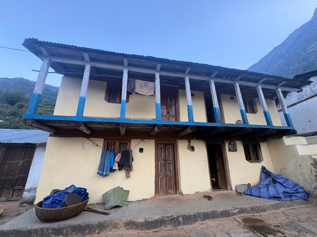

I was looking for a dhaba to have some food. I decided to pitch my tent somewhere near the road side there was a open ground. At that moment only important thing to be taken care of was food, as i had not eaten properly since morning and walked between 10 to 15 km. One local guy showed me a shop from where i restocked my ration, and he took me to his house. As i was alone, he asked to pay 800 rupees including stay and food.
In the evening, i came to know that in the next house few soldiers are staying. They are also leaving tomorrow for Kuari Pass Trek and will go to Auli. I met them and we decided that tomorrow morning we will leave together. Food was delicious and hospitality was great. This marks the end of this Section. In the next section i will discuss about the route from Pana – Joshimath.
Final Note for Independent Hikers
If you are interested in learning independent and solo hiking in the Indian Himalayas, you can opt for the Life On Trails Field Bootcamp in Manali – a 5-day field bootcamp, not just theory.
Where I share my knowledge from hiking 1100+ km from Uttarakhand to Leh Ladakh. I teach Navigation Techniques, Campsite & Shelter Selection, Food & Water Management, Topography and Contouring, Minimalist Gears, Season & Weather Selection, Wildlife & Safety, and Culture & Villages.
You can reach out to me on WhatsApp: 918800822842 or visit lifeontrails.in